Time of the year: all year round
Duration: about 3:30 hours
Length: 8,4 Km
Monte Cogne is a top in a strategic position. In this excursion we suggest to start from Malga Vernera, in order to reach the summit walking on the great dorsal between Altopiano di Piné and Valfloriana.
Among the point of interest along the path we point ouf Località Cimatti and the panoramic summit of Monte Cogne.
The route in detail
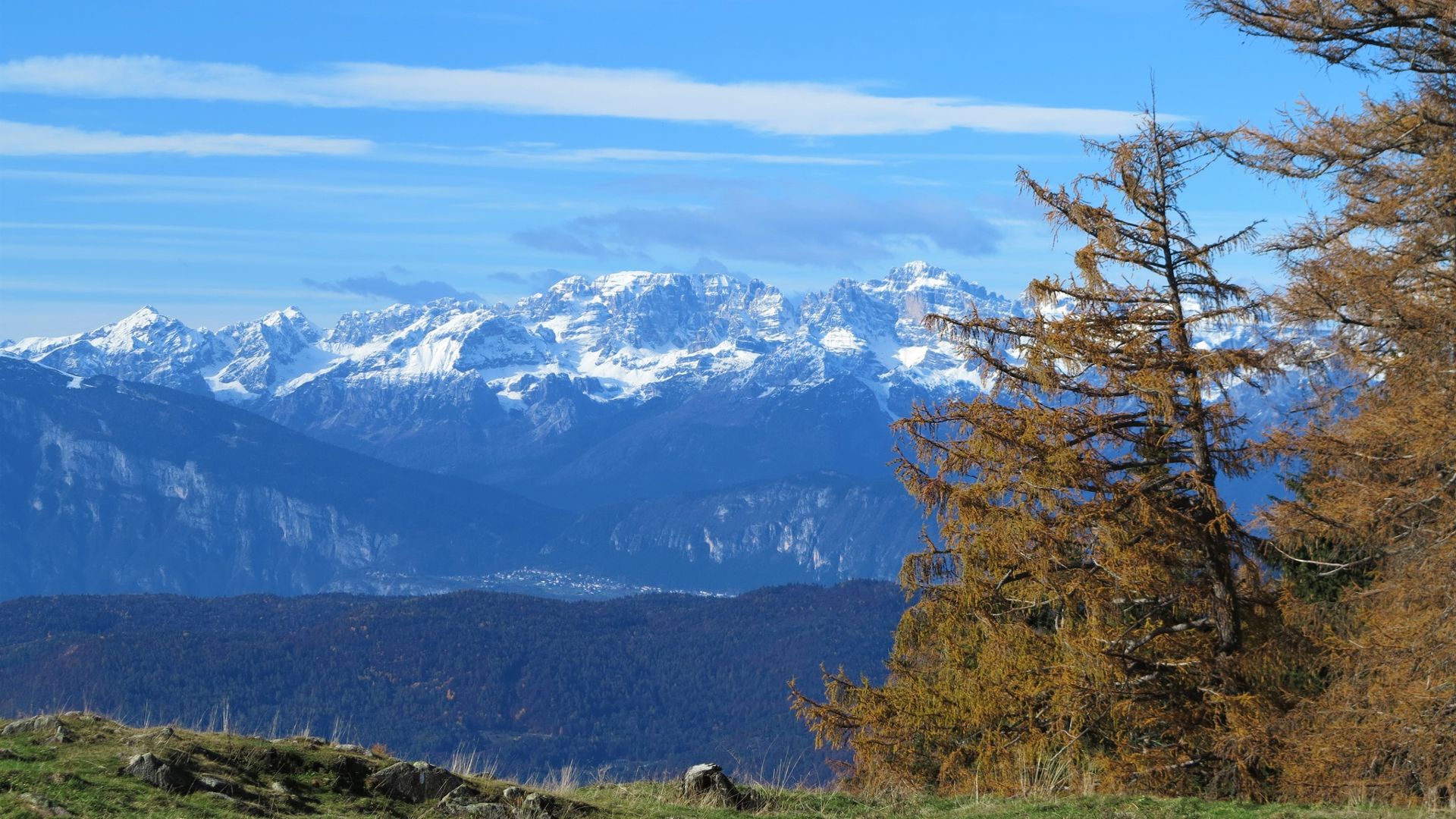
From Vernera hut follow the forest southwards that conduces at the small church of the Italin Alpine trooper, for then continuing until Camorè locality (you should encounter some huts). Don't get confused from a forest road that turns left but follow the main road until Camorè (about 1,7Km from the start). Now leave the forest road for a path on the left with indication "Malga Vasoni Alti e Malga Fregasoga" path n° 468; the path continues steady in the spruce wood. Once arrived at some indication that mentions again "Malga Vasoni Alti e Rifugio Tonini" turn left, leaving path 468, for an evident path with "Cimatti e monte Cogne" indication; the sign is attached on a big tree and not on the wooden pole together with the others. Following this path you will shortly get out of the woods, reaching Cimatti's locality. Now, on path n°469 follow "passo Mirafiori e monte Cogne" indications, continue on a pleasant slope until Frattoni mountain and then until Monte Cogne's top. Reaching the summit through the great dorsal between Altopiano di Pinè and Valfloriana is a very exciting experience. Once on the top, we just have to turn 360 degrees on ourselves to admire the hundreds of mountainc that surround us; from the closest, i.e. Fregasoga mountain, Pala delle Buse and Rujoch to the furthest like Marmolada with its magnificent rocky south wall, about 1000 m high, the Ortles-Cevedale group and Brenta grup. The view on the plateau is breathtaking too, with its two lakes that reflect the sky. The way back takes place on the same route.
Learn more about the itinerary on Outdooractive
Learn more about all hiking itineraries
Image gallery


