Candriai - Monte Bondone
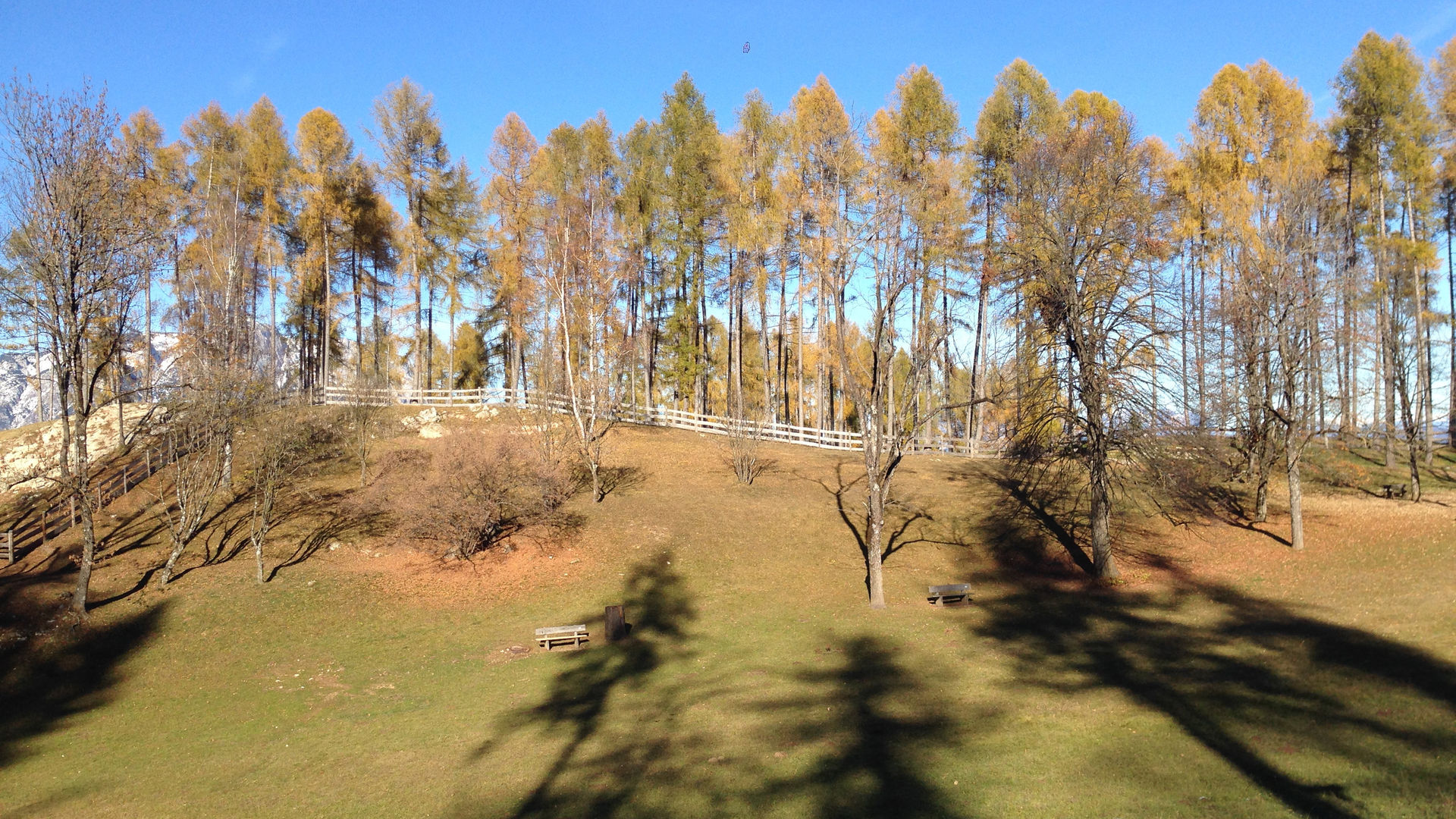
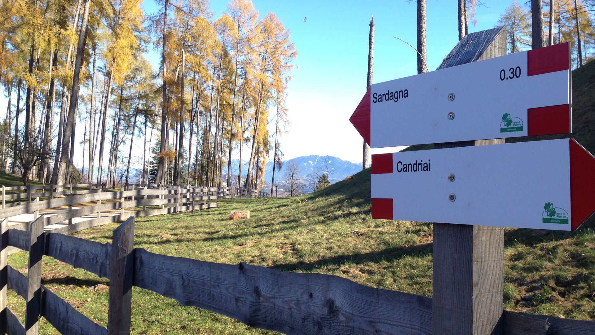
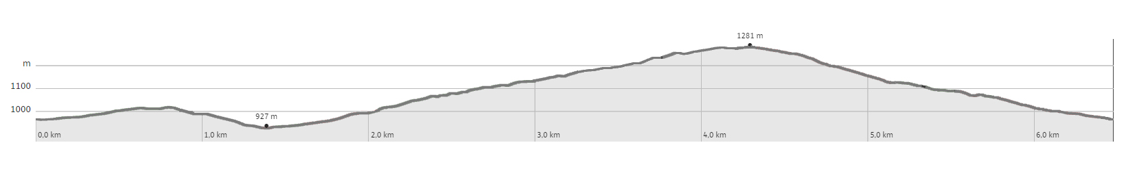
The starting point is in the parking lot at the sports fields in Candriai. You follow the main road going west and soon you find signs for Malga Brigolina. Going up a slight incline, you walk past an isolated house on your left. After about 100 m, you turn right on a path without signs, which leads downhill to the paved road that leads towards Malga Brigolina and Mezavia. You cross the road and, also on a path on a slight downward slope, you reach a forest road near a water collection tank. Travelling along the forest road, now along trail SAT 628, you reach the large pasture and, moving uphill, the Malga Brigolina. Having crossed the paved road, you continue uphill along the mule track marked SAT 628, in the direction marked Pra de la fava. Coming within sight of the first house, you leave trail 628 and turn left. After passing the second house, on the right you take a narrow path cordoned off with two picket fences, which first leads to a road that leads to private property, and - immediately afterwards - to the right again and uphill, through the forest until you reach another road (via del Lavachel), which, uphill, leads to the bend at an altitude of 1225. Immediately on the right, you take the second road and, along a short path, you climb to the paved road - Via dei Daini - which leads to the piazza in Vaneze, near the bend in the provincial road. Following the latter to the bend below, it is possible to take trail 645 for a short distance. At the first hairpin bend, you leave 645 and continue on a beautiful trail called “Trento Nostra”, which is clearly marked and leads downhill to Candriai. You cross the provincial road three times, so be careful of the traffic. This route is also suitable to walk in the opposite direction, or starting from Vaneze or from Malga Brigolina.
Learn more about the walks and trails of Monte Bondone and the Piné Plateau
Discover all the trekking proposals
Image gallery


Candriai - Monte Bondone

Mappa / map / Karte
The path
Don’t miss
The great Beech, Skippy’s fables, and ancient and modern trails
Start point
Contacts