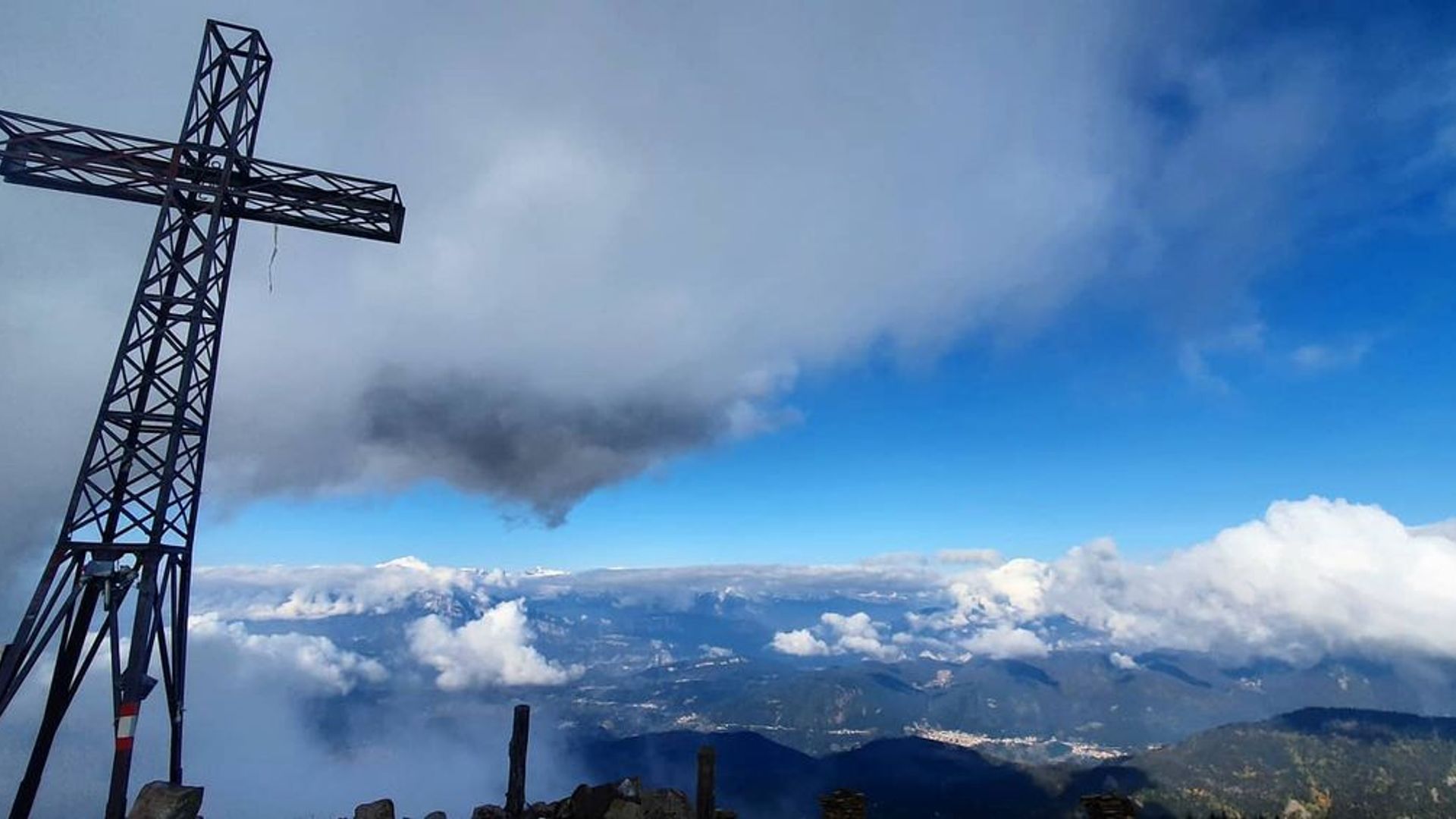
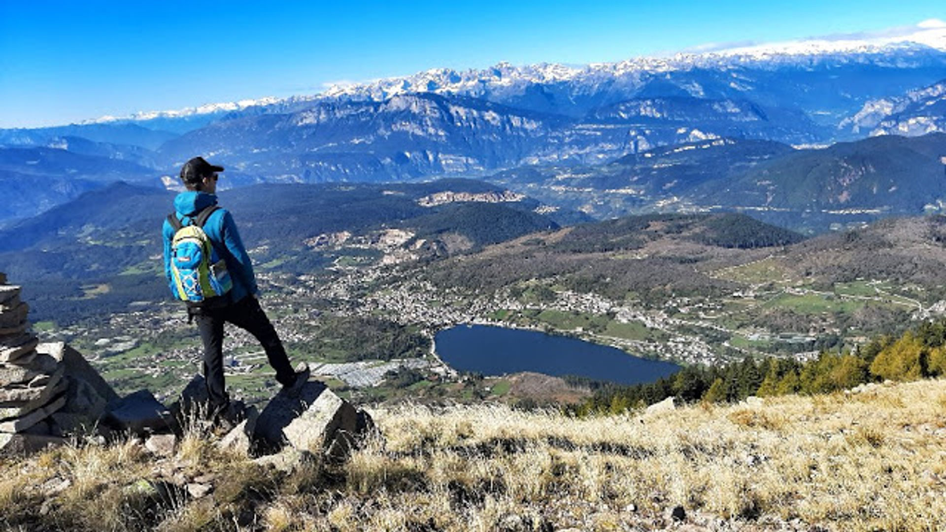
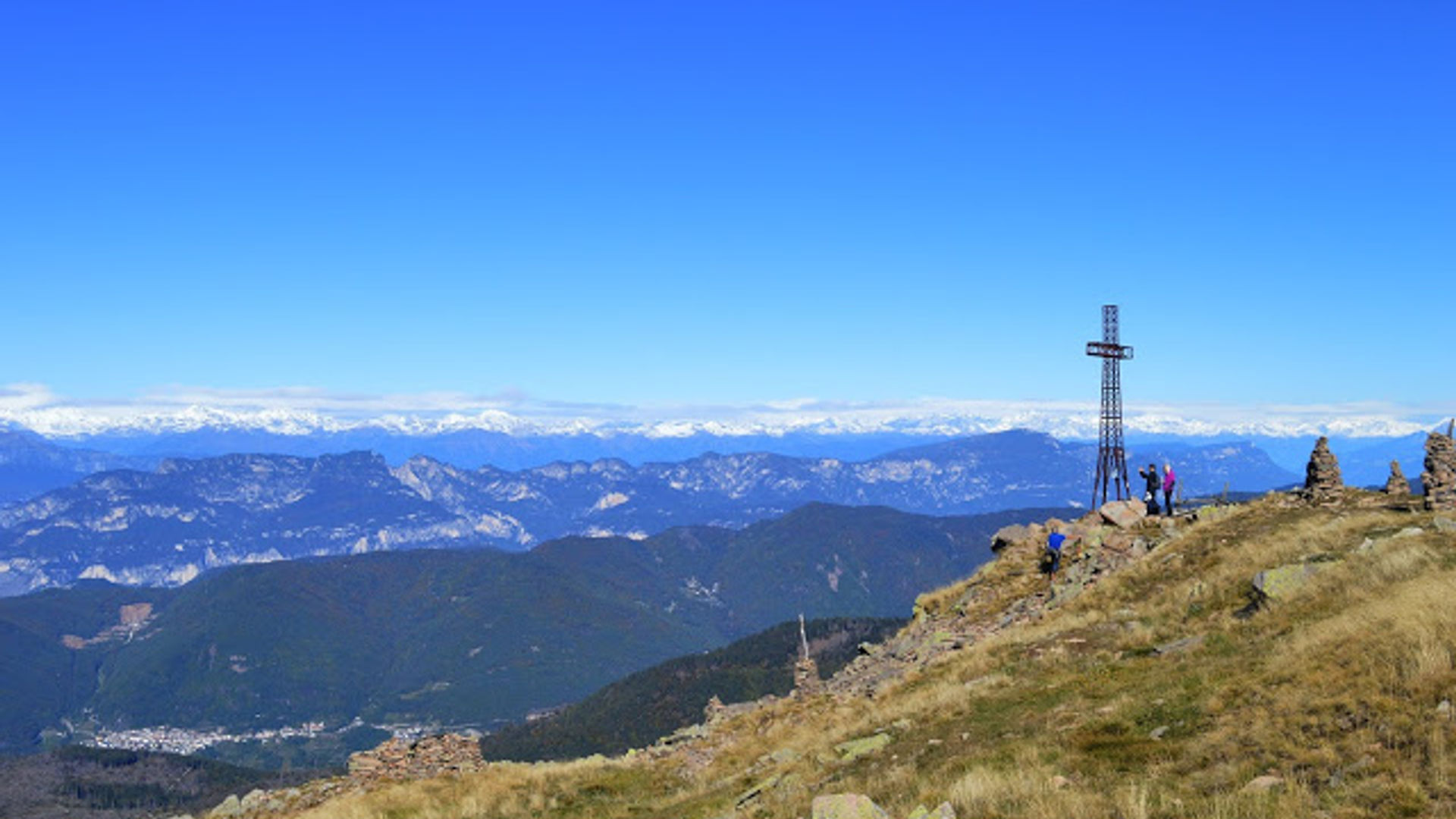
Beautiful, pleasant hike to the panoramic "Dosso di Costalta" with views of the "Serraia" bathing lake, the Lagorai mountain range and the Brenta Dolomites. It is the best known and most popular mountain of the Pinè plateau and lies on the border with the Mocheni (Bernstol) mountain valley. It takes about two and a half hours to reach the summit. You pass by the Malga Cambroncoi alpine pasture (1710 m), which offers refreshments in summer and winter. The way back is along the old military mule track "Senter dei Russi", which was built by Russian prisoners during the First World War.
The route in detail
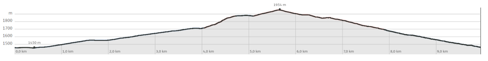
At the Redebus Pass (1453 m), follow the SAT Alpine Association trail no. 404. It leads uphill through the forest and then meets a forest trail on the right. Keep to the left and hike to the mountain meadows of the "Pec" alpine pasture (1582 m). Once at the alpine pasture, trail 404 leads to the right, on the north side of the alpine pasture, again into a forest that was partly badly damaged by the Vaia storm. After a short climb, the trail goes moderately up and down to the Malga Cambroncoi alpine pasture (1709 m), which is surrounded by beautiful alpine meadows. Now descend a little below the alpine pasture (west side) until you reach a bend. Here you leave trail 404, take the narrower trail and go straight ahead at the bend. You cross the entire alpine meadow (see the sign "Giro delle Malghe"), pass a spring water reservoir and come to a sign where the trail reenters the forest. The narrow path climbs somewhat more steeply in numerous narrow hairpin bends. At 1850 m above sea level, you come out of the thinned-out forest again and meet trail no. 404, which you continue along to the right. Then there is a final climb and a last section of forest that separates the lower meadow terrain from the upper alpine pastures that reach up to the summit cross. Large cairns and the summit cross in sight, show the way to the summit experience. After enjoying the grandiose panorama and the well-deserved break, you return the first section on the same path. At the fork in the path, keep slightly to the left and first take the meadow path in an easterly direction. Soon you enter the forest, go downhill, reach a signpost and the Russenpfad (1878 m). Keep to the right and follow the forest path E 457, which later meets a large clearing that you cross in a south-easterly direction. The path leads back into the forest and back to the starting point of the hike. Along the route there are beautiful views of the village of Piazze and its lake of the same name, as well as of Monte Ceramont (1514 m), which rises above the lake to the north.
Learn more about the itinerary on Outdooractive
Learn more about all hiking itineraries
Image gallery