Time of the year: from late spring to autumn
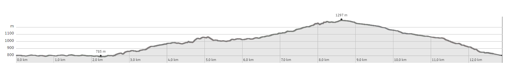
Duration: 5 hours
Length: 13,8 Km
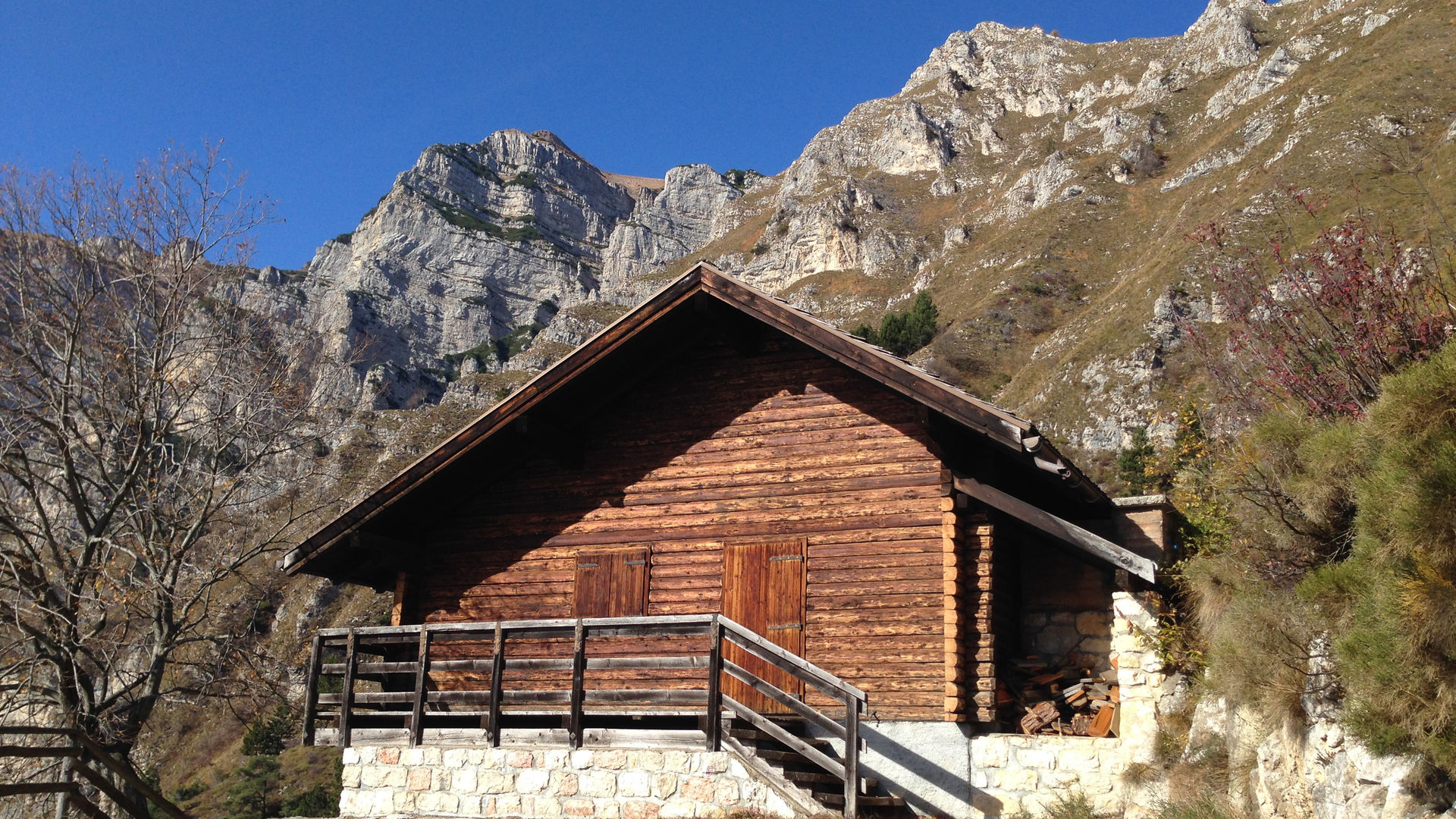
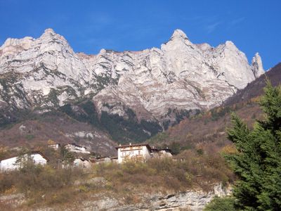
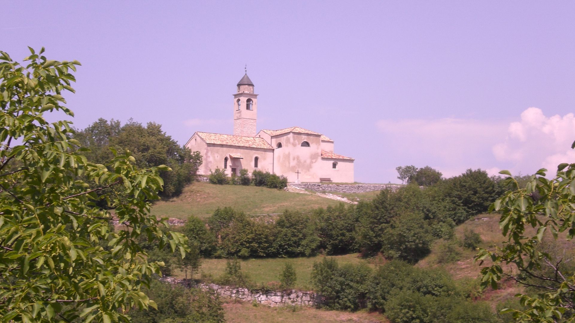
From the small parking area next to the Garniga Terme park, you take the provincial road in the Garniga Vecchia direction, leaving it not much further on, at a bend, where a dirt road leads off to the left. You follow the dirt road uphill in a south westerly direction. At the fork, you turn right, following directions for Sentiero di Malga Albi, and take a gravel mule track which climbs the north face of the mountain, until you come out, levelling, on the east face, right above the town. At the turn-off, you leave the Malga Albi directions behind and continue straight along the path, which, continuing to climb, comes out at a pasture and reaches the paved municipal road which goes from Garniga Terme to Malga Albi. You follow this road briefly and, at the turn-off, go left following directions for Chiesetta di Rocal. The road leads to the small church, built in 2012. From the piazza in front of it, a path begins, leading to a bend in the paved road that you left before. After the next bend, you turn right on a path that makes it possible to cut a section of the paved road, leading you further up, to another bend. You soon reach the beautiful meadow-hollow of Malga Albi. For those who do not wish to follow the entire route, this can be considered a valid destination, and you can return to the starting point by following the same route back again, or one of the numerous other trails that lead to Garniga Terme. It is also possible to reach Rifugio Sparavei, following trail SAT 630, which is in a beautiful panoramic position. Once you have returned to Malga Albi from this detour, the route continues in a north westerly direction, crossing pastures above the farmstead, to the northern boundary, where a dirt road leads downward into the forest. At the first turn-off you turn left, in the Strada Selva direction, which soon becomes a narrow path that follows the steep slope of a beech forest, until it ends on a forest road. The route turns downhill, along the forest road, with a few bends. At the sixth bend, on the right there is a dirt road that goes on a gentle downhill slope towards the Valle Magna, reaching the base of the Le Crone promontory. The dirt road climbs to a fork, where you turn left and, continuing to climb, reach an evident intersection. You take the road to your right, which leads to the southern face of Le Crone, and soon becomes a mule track, which climbs down towards Garniga Vecchia and reaches the provincial road just above the last houses of the village. Once you reach the bend below, you go around the building on the bend and you descend along a path that crosses small cultivated plots, reaching a small paved road that leads to the Cà de Soto hamlet, and, continuing downhill, joins a dirt road along the east face of the mountain, leading to a bridge over the stream and, on a level, leads to Zires. From this point, you reach the cemetery church of S. Osvaldo, and then head downhill before climbing to the starting point.
Learn more about the walks and trails of Monte Bondone and the Piné Plateau
Discover all the trekking proposals
Image gallery


The path
Don't miss
Church of Rocal, pastures around Malga Albi, Rifugio Sparavei, Beech and Fir forests, the towns of Garniga Terme and Garniga Vecchia, and the cemetery church.
Start point
Contacts