
animali del Monte Bondone
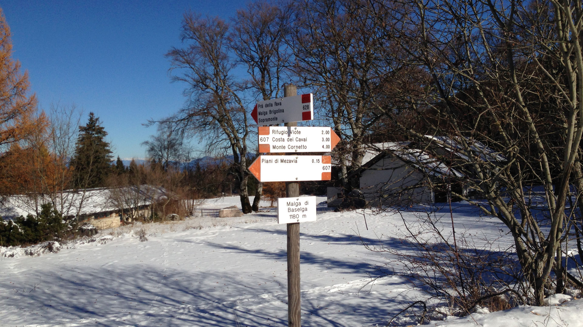
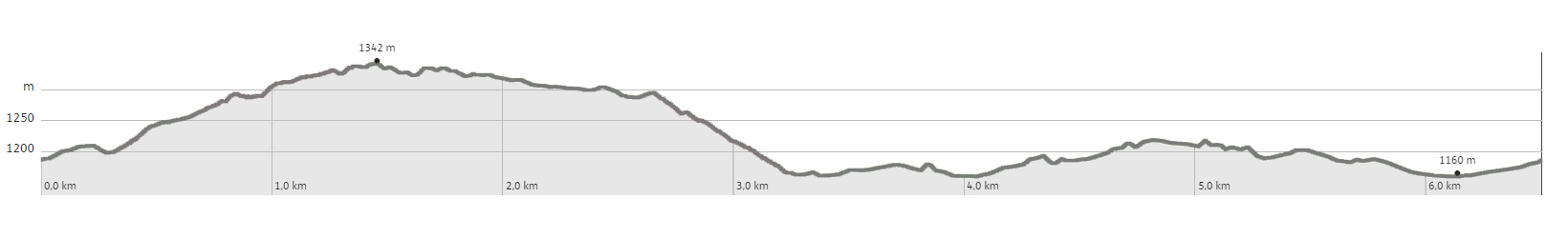
The route is described starting from Mezavia-Malga di Baselga, but by extending it by just over 1 km, it can also start in Pra de la Fava or in Vaneze. From the point in front of the station at the bottom of the Rocce Rosse ski lift, you take the dirt road marked SAT 607 Rifugio Viote. You continue, cutting a few bends in the road by means of the path, until you finally abandon the road entirely. The path continues on a slight incline to a fork, where the SAT signs mark a sudden change in direction. You continue straight uphill for a short while, and end up on the "Strada de Mez" dirt road. You soon come to an ample clearing with a noteworthy view of the upper Valle dei Laghi, and the Brenta Group. Here, you will find the Baita dei Caciadori, where you may wish to stop. You continue towards north-east, through a Fir forest, and reach an intersection, marked by numerous wooden boards. You follow the direction marked with the sign 11 Brigolina, along a downhill path, which reaches the Selva forest road running further below. Once you reach it, you turn left, following the signs for SAT 628. You soon reach another of the tables telling the fable of the Bondone and Skippy the hare, already encountered in route number 6. You continue to follow the forest road, on a slight hill, and find other fable-tables until you return to Mezavia, where fable number 12 is displayed. If you start the route in Pra de la Fava, you need to reach the beginning of the Selva forest road, located near the last house (a modern one) on one of the paved roads running through this town. From Vaneze, you need to reach the beginning of the Strada de Mez, located on a bend at an altitude of 1225 m.
Learn more about the walks and trails of Monte Bondone and the Piné Plateau
Discover all the trekking proposals
Image gallery


mappa / map/ Karte

The path
Don’t miss
The woods, Skippy’s fables
Start point
Contacts