Time of the year: all year round
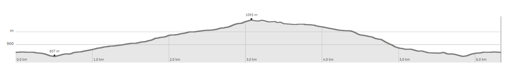
Duration: 2 hours and 30 min
Length: 6 Km
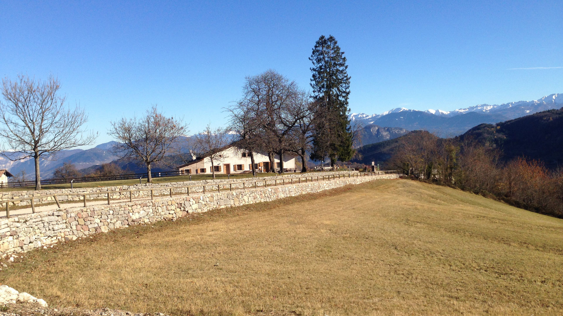
Sant'Anna - Sopramonte (Trento)
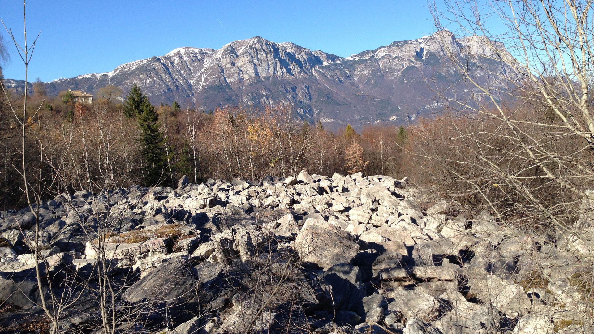
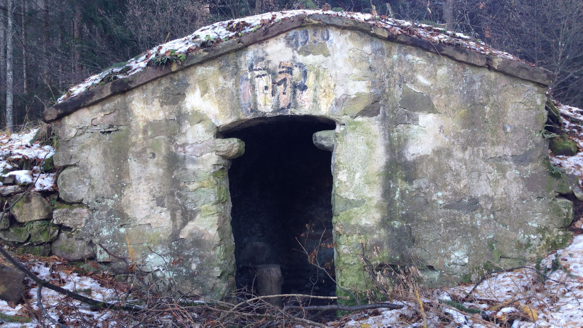
From the hamlet of Sant’Anna, which can be reached from Sopramonte, the route develops downhill along the dirt road in a south-easterly direction. At a fork with a wooden sign indicating “Strada forestale Lavé”, you take this direction, heading south. You soon reach another fork, where you turn right again, and - heading up a hill that is never too steep - you climb the slope characterised by the presence of an enormous landslide - by now almost entirely covered by forest - which broke off in a forgotten time from the side of the Palon, at an approximate altitude of 1850 metres. At the end of the forest road, you meet the municipal road that connects Malga Brigolina with Mezavia. You turn left and continue on a slight downhill slope, until you reach another fork, with a resting area to the left, as indicated by the sign. The dirt road continues downhill to a clearing, with benches and a peculiar, dome-shaped refuge building. You continue along the dirt road - now gravel - closed in a valley, which in some points is quite steep. The last section of the road is flat, and connects to the Lavé forest road at the aforementioned turn-off. From here, all you need to do is follow the road back - up a slight incline - to reach Sant’Anna again. It is also possible to start this route from the town of Sopramonte, following the road that goes through Maso Tomba, directly reaching the beginning of the Lavé forest road. The closest bus stop is about 1700 m from this part of the road.
Learn more about the walks and trails of Monte Bondone and the Piné Plateau
Discover all the trekking proposals
Image gallery


The path
Don’t miss
Sant’Anna Hermitage, the typical rock landslide (Lavé), Ululone Wells
Start point
Contacts