
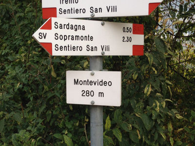
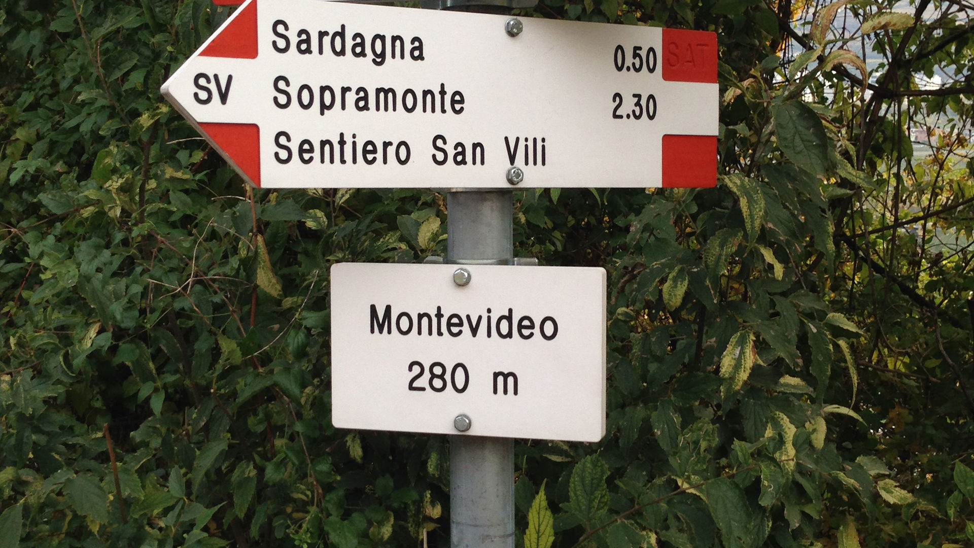
Sentiero di San Vili
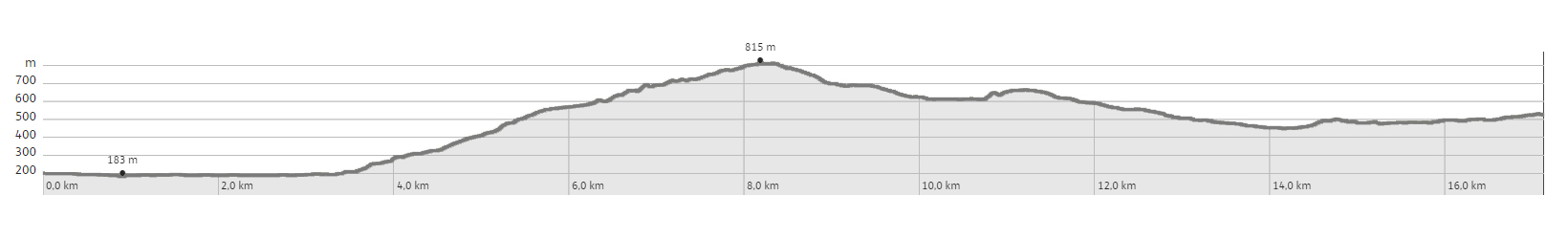
Created by the SAT in 1988, the Sentiero di San Vili (San Vigilio), patron saint of Trento, joins the city of Trento with the town of Madonna di Campiglio. It was created as a cultural bet on finding a connection between the city and the mountains, and is intended to mark the differences in rural landscapes, historical events, and geographical changes in the territory it crosses. There are two routes that this trail follows: a high (alto) road and a low (basso) road. The one described here is the first part of the low road, and connects the city of Trento with the towns of Vela, Sardagna, Sopramonte, Baselga del Bondone and Vigolo Baselga, and beyond. From the cathedral in Trento, the path leads towards the Adige, crosses it, and follows it up towards the suburb of Vela, north-west of the historical centre. It then climbs the slopes of Monte Bondone, following a section of provincial road 85, before climbing along via del Maso Scala. Having crossed the provincial road, it continues along a dirt road to Sardagna, runs along Via del Ronco d’Andrea, and then climbs a mule track - an ancient route to the Camponzin Pass. When you reach the pass, the route descends towards Sopramonte. After crossing the town, it heads west towards Via del Dòssol, and finally along a mule track towards the hamlet of Croseta. After the climb, the path goes down to Baselga del Bondone and soon reaches Vigolo Baselga, where it is crossed by state road 45 bis, and enters the town. From the piazza, you go downhill through the countryside until you reach the cycling lane, which leads in a western direction towards the town of Vezzano. Once you have reached the ridge, the route travels around Monte Mezzana in the Covelo direction.
Learn more about the walks and trails of Monte Bondone and the Piné Plateau
Image gallery


mappa / map /Karte

The path
Don’t miss
Historical buildings, churches, farmsteads, mule tracks, woods, meadows, cultivated land - all the tiles in a mosaic that tells the story of the history and culture of this territory
Infos
From Covelo it is possible to return to Trento by bus (see timetables www. trentinotrasporti. it or +39 0461 821 000)
Start point
Contacts