Forte di Romagnano
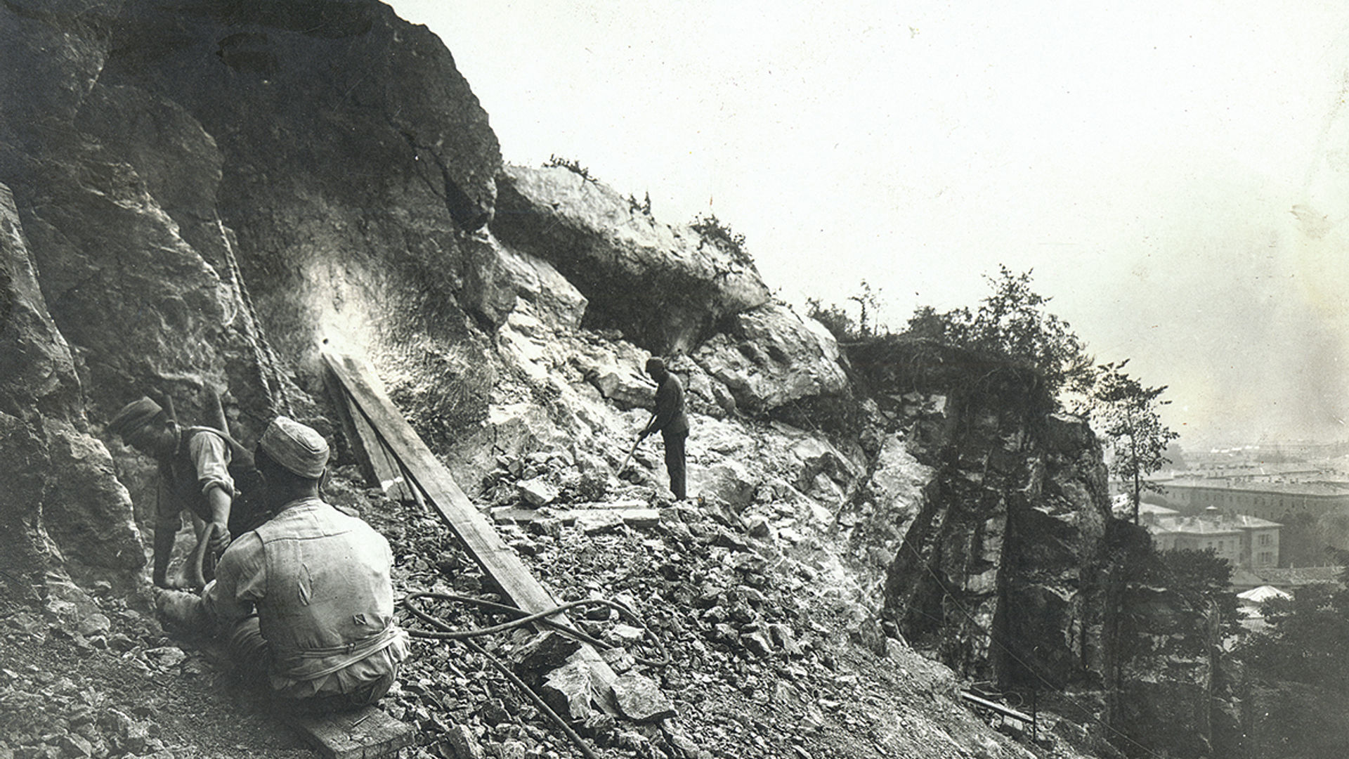
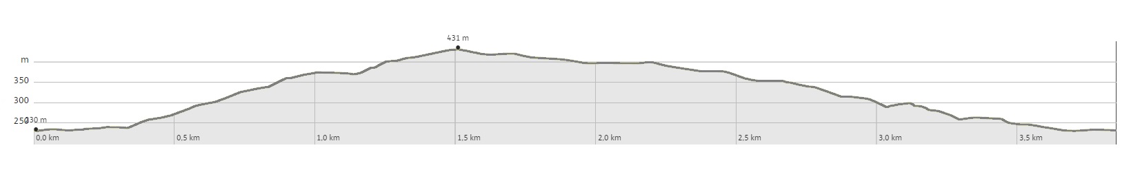
From the village of Romagnano, which can be reached by bus from Trento, go up the path 614b called the Sentiero delle caore, reaching the stronghold above the town. Leaving the path to the right, it is possible to see traces of trenches and some cave works. Ascending the path for a little longer, you will reach the road that leads to the Fort of Romagnano. After the fort, follow the asphalted road that goes down to the Locanda Margon. At the end of the road you skirt the countryside until you find the path that descends towards Romagnano. A beautiful panoramic point of the valley is placed above the remains of a defensive work from 1915. At the end of the path, a small road that runs alongside some fields leads in a few minutes to the village of Romagnano.
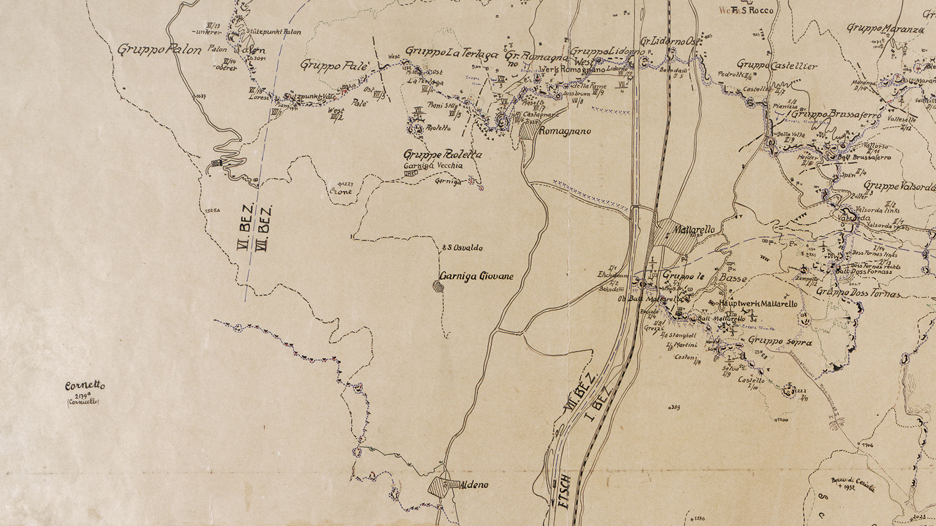
The VII sector of the Fortress started from Monte Bondone and went down to the town of Romagnano and the Adige valley.
Discover all the trekking routes of the Great War in Trento and surroundings.
Image gallery


The path
NINETEENTH-CENTURY FORTIFICATIONS IN SECTOR VII
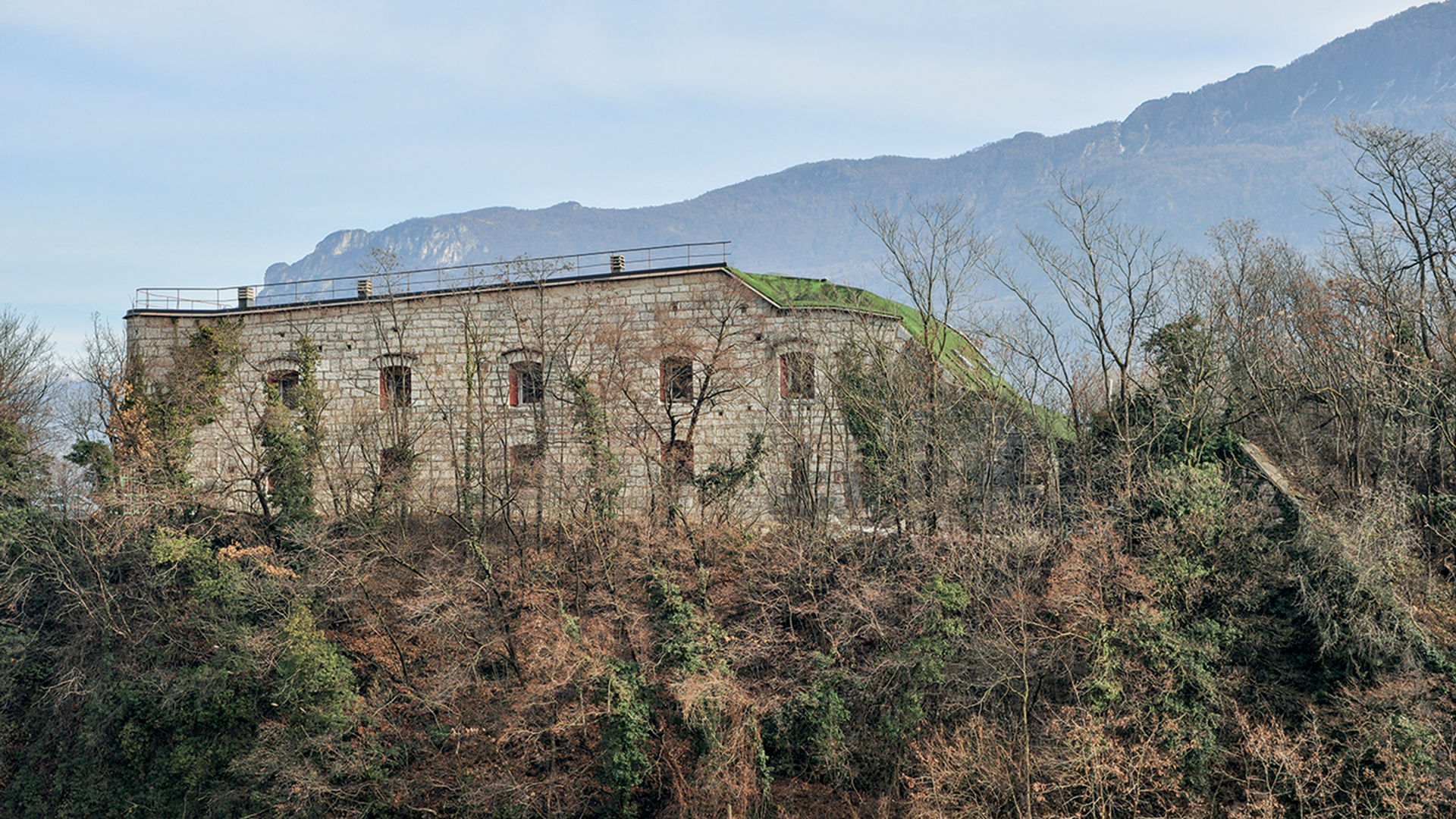
Fort Romagnano
- year of construction: 1896-1899
- typology: fort
- ownership: private
- opening to the public: no
- state of preservation: restored
Start point
Contacts