Monte Bondone
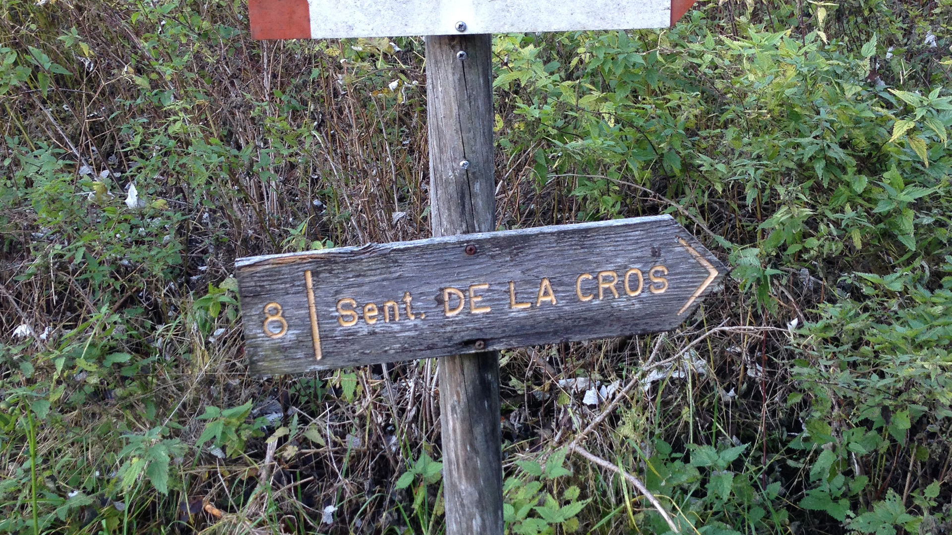
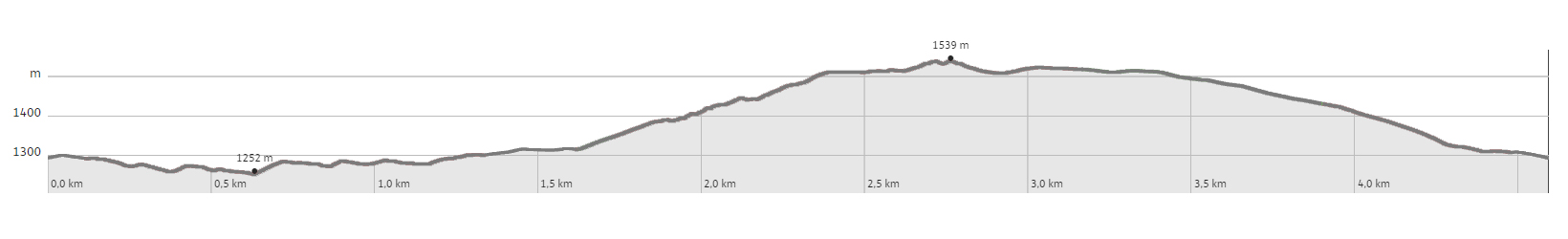
In Vaneze, at the beginning of the Street Còrno, you walk down to the playground, to the last building (formerly the Studio Uno Discotheque). The path to take is the one that goes downhill, indicated by the sign marked with number 7 - Caporal-Corno trail, attached to a fir tree. After a few bends, the path enters a beautiful forest, on a slight incline, and reaches a typical promontory (Dos del Caporal). The path now continues uphill, passing a few small valleys and, with a few bends, reaches a paved road in the village of Corno. You turn left, following the road that becomes a dirt road and exits the forest. Near the last house there is a sign (8-Sentiero de la Cros), it indicates a steep path that climbs the meadow and, still on a steep incline, crosses the forest, climbs the north-eastern ridge of the Dos de la Cros, until it reaches a beautiful and panoramic field on a pass. The peak is on your left and, to reach it, it is necessary to climb up a narrow path to the cross, where there is a sweeping view. When you return to the pass, the route heads west, climbs up a modest plateau and then descends the opposite side, following a dirt road. Passing beneath the ski lift 3-Tre, you reach the meadows of the skiing slopes. When you reach the Montesel ski lift, without walking past it, the route descends directly along the slope, until it once again crosses ski lift 3-Tre, and reaches the beautiful little church in Vaneze. From here, shortly, you return to the starting point, passing beneath the ski lift starting station.
Learn more about the walks and trails of Monte Bondone and the Piné Plateau
Discover all the trekking proposals
Image gallery


mappa / map / Karte

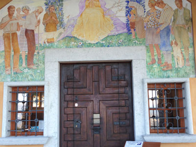
chiesetta di Vaneze - Monte Bondone
The path
Don’t miss
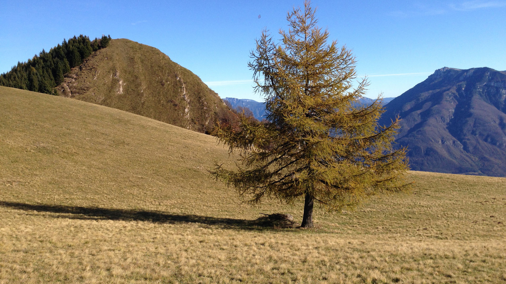
The Fir forest, views, the Monte Bondone skiing slopes, the church of Vaneze
Start point
Contacts