Time of the year: from spring to autumn
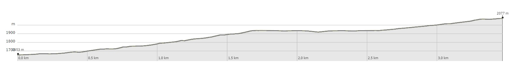
Duration: about 2 hours
Length: 3,5 Km
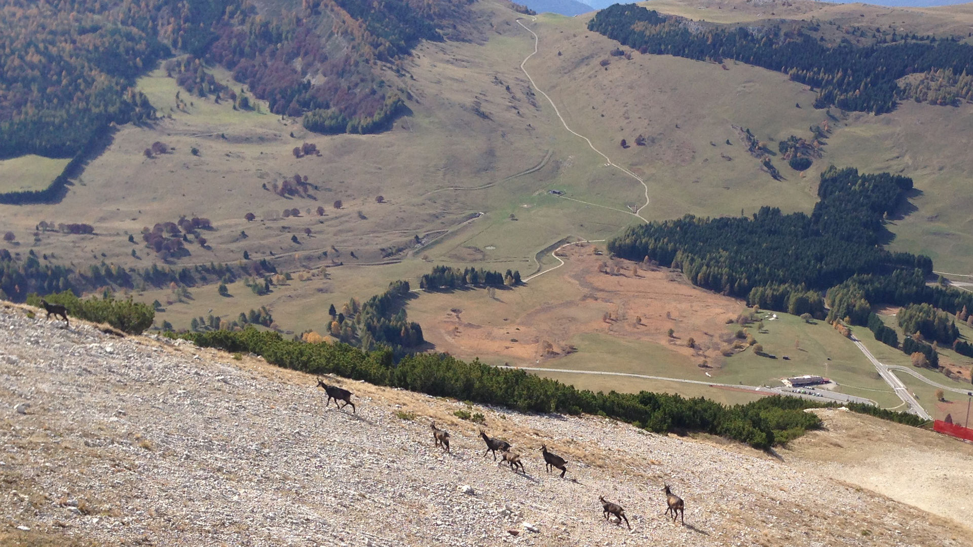
This is a route that can be taken by climbing or descending with the ski-lift. The description refers to climbing on foot. Near the Vason pass, going around the first building, a path starts on a slight incline, passing beneath the Palon ski-lift, crossing the skiing slope and then joining the military mule track called Sentiero dei Mughi. The route climbs the northern face of the Palon, always on a slight incline, except for a few steeper areas, where the path must overcome a few less visible areas of the mule track. At an altitude of 1940 m a small road leads to the Mugon crest, where you will find the ruins of an Austro-Hungarian observatory and the anti-avalanche apparatus. The spot has a beautiful view. Once you have returned to the road, you can continue to climb along the path, which still flanks the ski-lift, and soon you reach the skiing slope that descends from the Palon peak. A few more metres and you reach the plain where the top station of the ski-lift is, dominated by the high telecommunications tower on the peak. During the climb it is possible, with a few detours, to visit some Austro-Hungarian military structures. The lowest one is in the process of refurbishment, and the path that connects the walkways is still not well marked. At a greater altitude, following the indications provided by the tables, it is possible to visit the five caves built in a valley and the “generator cave”, which was home to an electricity generator unit serving all the posts on the Palon peak. To return to the bottom you take the ski-lift. Alternatively, you can follow the dirt road that serves the infrastructures located at the top which, following the Rocce Rosse skiing slope, leads to the Viote plateau, on the north-western face of the Palon. Once you reach the passage beneath the road, you leave the slopes and head north-east, following the panoramic walk described in route “Viote-Vason-Viote”.
Learn more about the walks and trails of Monte Bondone and the Piné Plateau
Image gallery


mappa / map / Karte
The path
Don’t miss
Trails and fortifications of the Great War, views, chamois of the Palon
Start point
Contacts